Singapore Plat Map 1873
Photograph
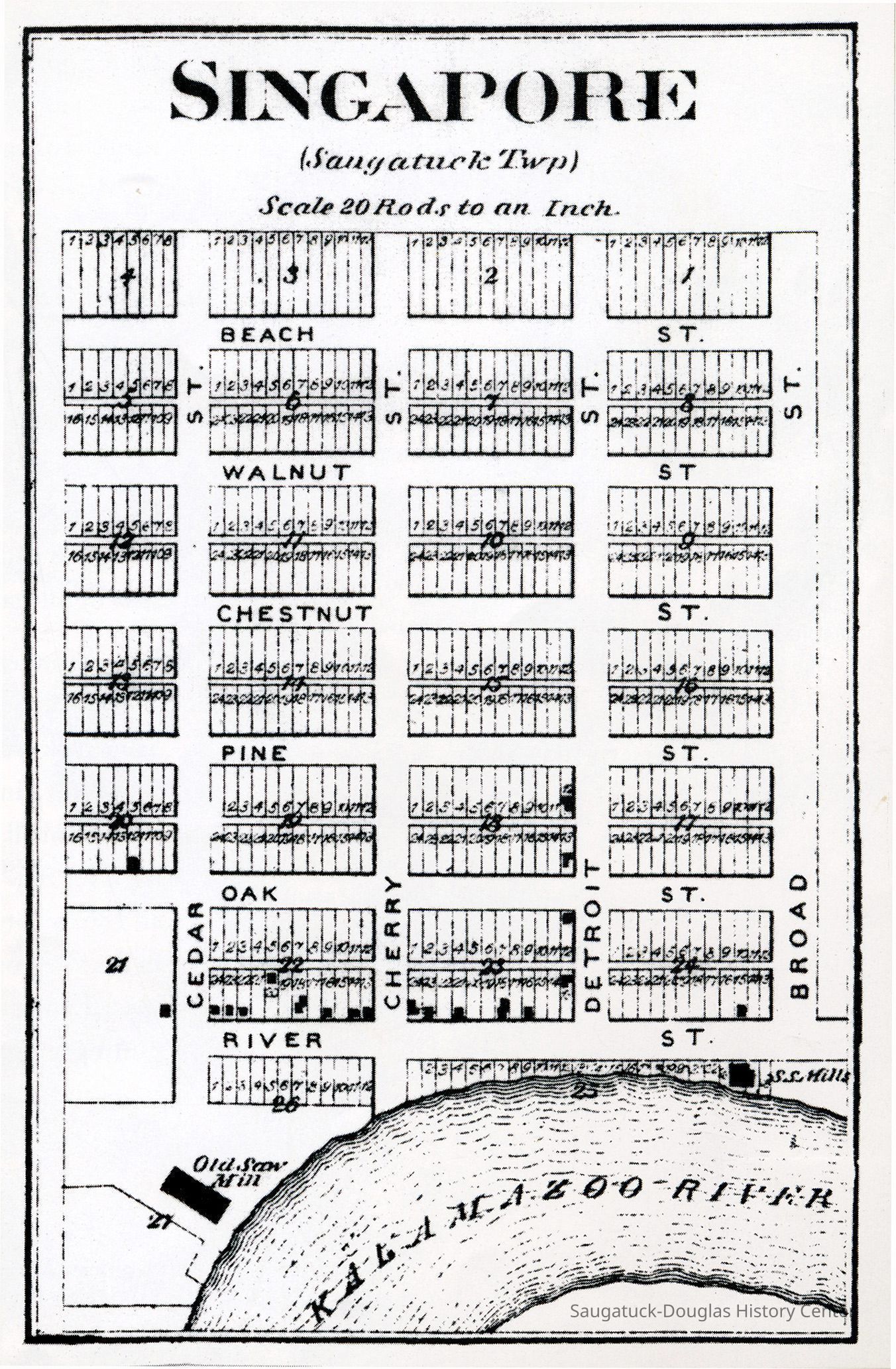
Scan of Singapore map from a 1873 Allegan County atlas by C.O. Titus that shows the location of two saw mills, the Kalamazoo River, and the proposed street and lot layouts.
2023.10.52
Digital scan
Singapore, Michigan 1837-1875
This map shows the aspirations of early Singapore promoters. The town never achieve even a fraction of this development. In a 1844 survey, River Street is the only east-west street shown
1836 Singapore
Winthers, Sally
2023.10
Found in Collection
Flat Files drawer 16 plat and property maps
These image(s) were copied from the SDHC photo blog [or the Jack Sheridan drive if that was a superior version] in preparation for updating the SDHC website in 2023. The location of an original or printed version of these photos was unknown at the time of cataloging.
04/17/2023
01/17/2025