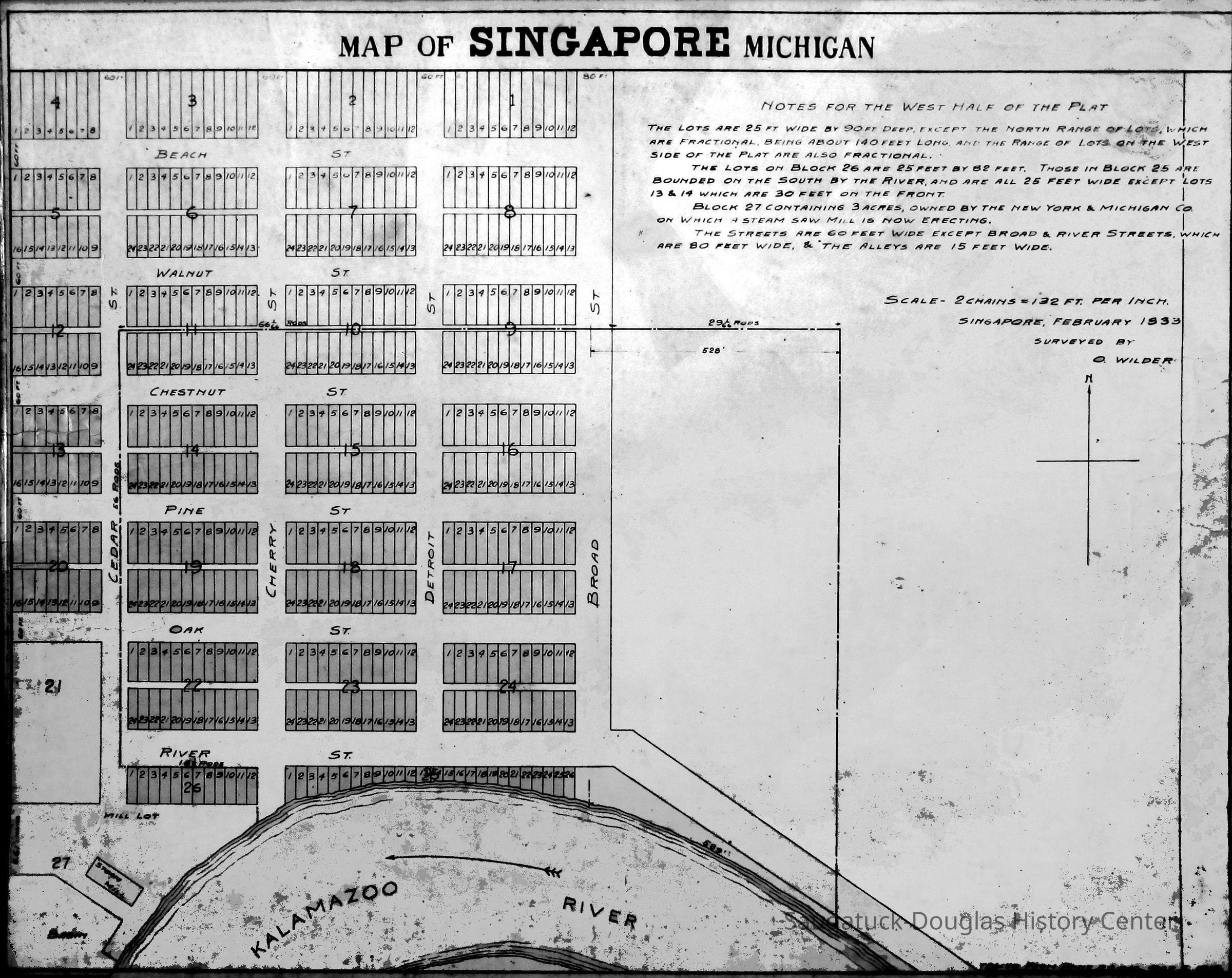
Singapore Plat Map, 1830s
2024.04.123
An aspirational rendering of properties in Singapore.
1836 SingaporeDevelopment, land1830 Settlement, pioneer era1835 Logging and Lumbering
Winthers, Sally
2024.04
Found in Collection
Digital data in CatalogIt
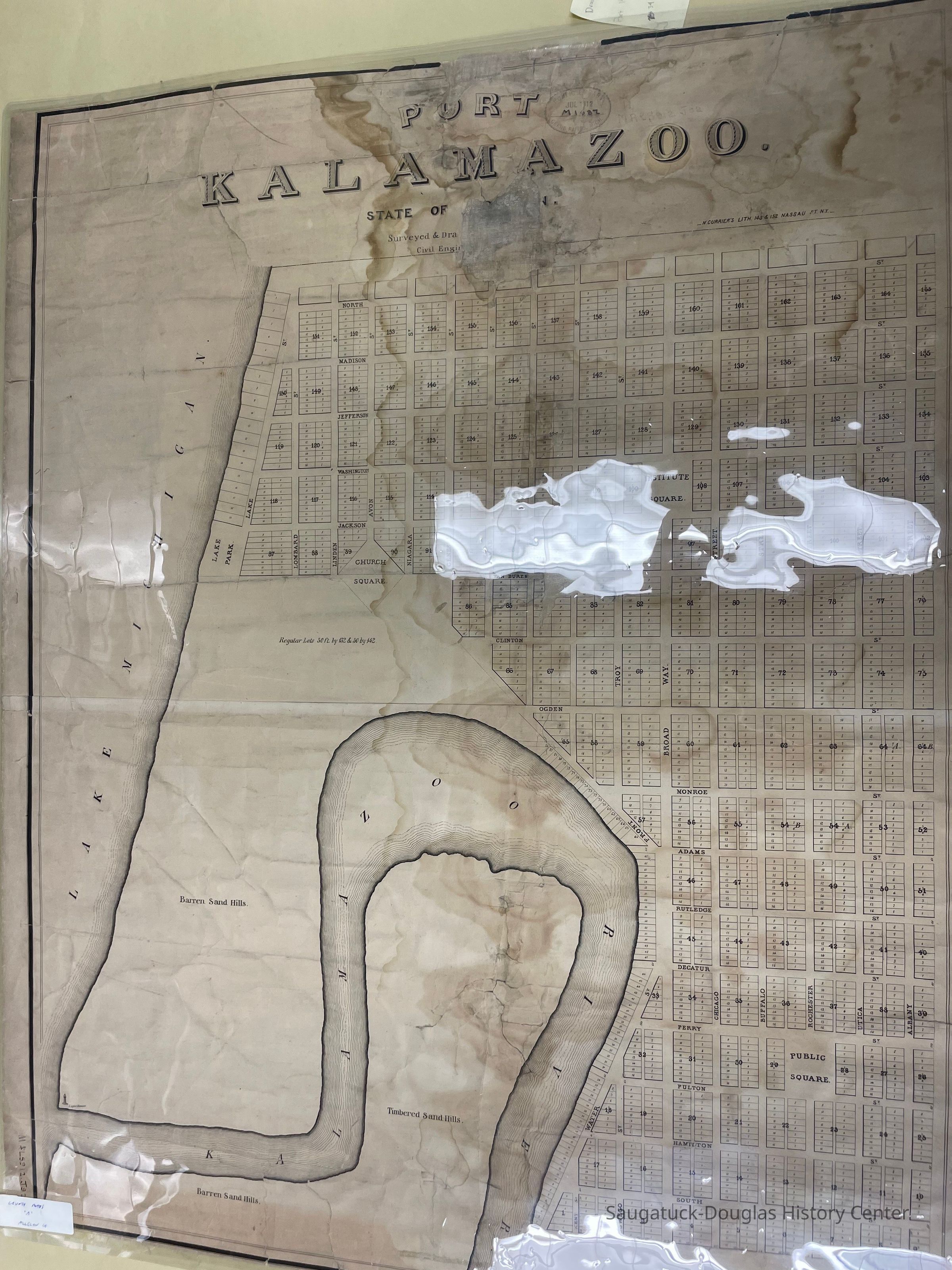
Wilder, OsheaPort Kalamazoo (before 1836)
Singapore, Michigan 1837-1875
Clark, Chris
Dec 1, 2024
Wilder's company purchased the land in December 1836. The plat was registered on February 5, 1838. Whoever made the map probably meant 1838 instead of 1833.
Faasen, James T.
Dec 2, 2024
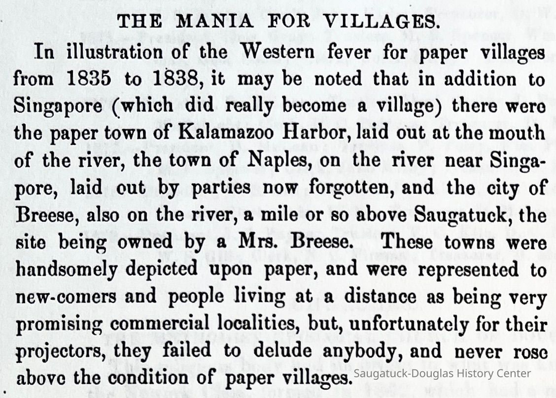
The date on that map might be significant and not just written off as a typo to support an established narrative. Tillitson and Carlos Barnes first acquired the land from the government, and that was not recorded in Washington until 1835, but who knows when they purchased it at the land office at White Pigeon. Judging from Butler’s letters, there is almost a two-year delay in that process. To my understanding, Wilder never owned the property but did survey it and set up the plat map. He may have been the on-site manager and ran a bank and store there in 1838, but he never owned it. In addition, there is that 1837 news article about that steamboat ride up the Kalamazoo River. Doesn’t that mention Col. Wilder building a Hotel there and planning to build a sawmill soon? I haven’t platted it out yet, but that circa 1835 paper town of Port Kalamazoo might match up well to a preexisting plat of Singapore and Kalamazoo Harbor as well No, I would think that the 1833 date on the Singapore map might be plausible. Remember 200 pages of deeds are missing in Kalamazoo records from about Jan 1835 to Dec 1835. I figure that’s about 150 missing deeds and recorded agreements and all would be a year or two old. I think there might be a lot more going on at Kalamazoo Harbor, Shriver’s Bend, and Singapore in those early years than is stated in traditional understandings of the development of Saugatuck.
11/30/2024
08/15/2025