Aerial 1955
Photograph
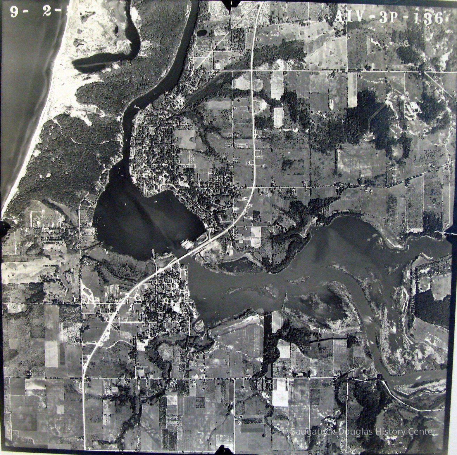
24"x24" black and white aerial photograph of the Saugatuck Harbor taken on September 2, 1955. According to James T. Fassen this was taken as a stereoscopic image to capture additional elevation information. A code in the upper right corner is AIV-3P-136.
Douglas is still dotted with orchards and large swaths of land are undeveloped.
2016.17.01
Print, photograph
Tara Restaurant/Spencer House/200 CenterRiver Queen Boatworks/81. N Ferry/Harbor Club/Harding Hotel, 2ndPier Marina/Saugatuck Marine 1947-1970sSaugatuck Fruit Exchange 1917-1956Big Pavilion 1909-1960
This map is significant for all it does not show: no I-196, Tower Marina or 2024 High School.
1870 Fruit growing, farming, agricultureDevelopment, land
Voss, Mary
2016.17
Bella, Victor "Vic"
Donation
1955
24 in
24 in
Flat Files drawer 15 photos
Good
Status: OK Status By: Mary Voss Status Date: 2016-05-04
05/04/2016
10/31/2024