Saugatuck Harbor 2025 Map
Map
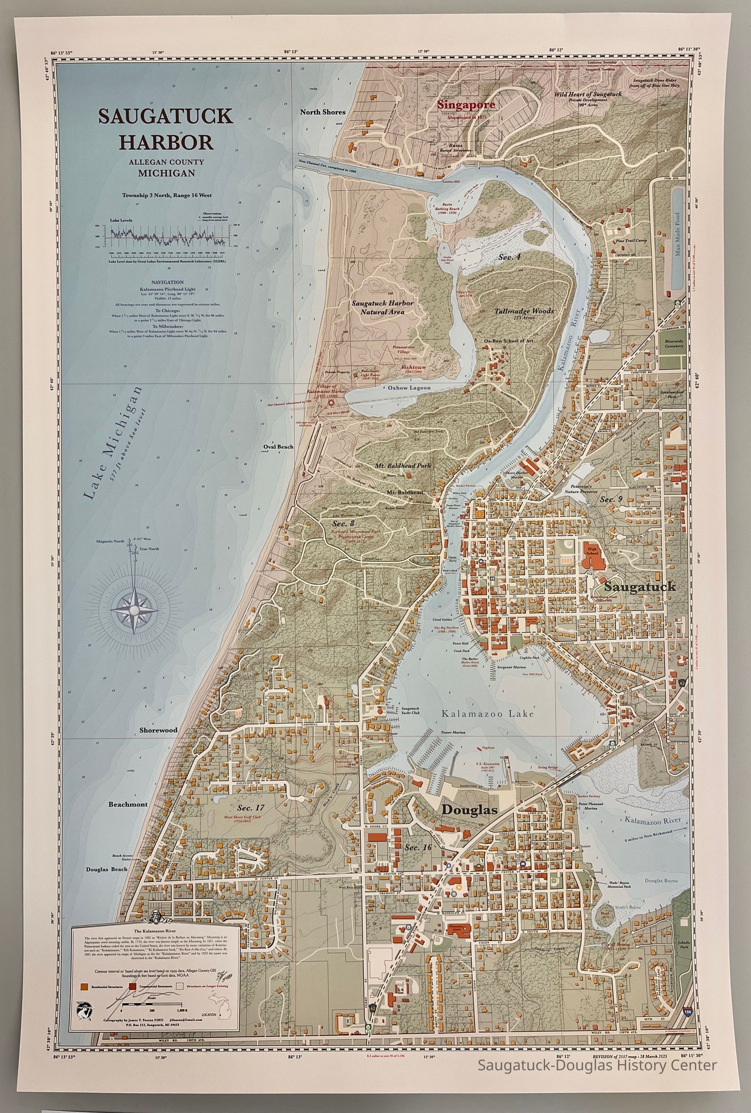
Highly detailed map that shows Saugatuck, Douglas and surroundings in 2025 from the northern boundary of Saugatuck Township to Wiley Road and from Lake Michigan to the Blue Star Highway. A new feature on the 2025 map is large, strangely-rectangular man-made lake along the upper right edge.
Numbered 38/300 and signed by the cartographer James Faasen
2025.27.01
This is the third map of the harbor area created by James T. Faassen. The previous maps documented the harbor as it was in 1875 and 2017.
Maps
Winthers, Sally
2025.27
Faasen, James T.
Donation, unconditional
Faasen, James T.
2025
30 in
20 in
Flat Files drawer 11 Local maps
07/15/2025
07/15/2025