Tanner's Universal Atlas 1833,1841
Map
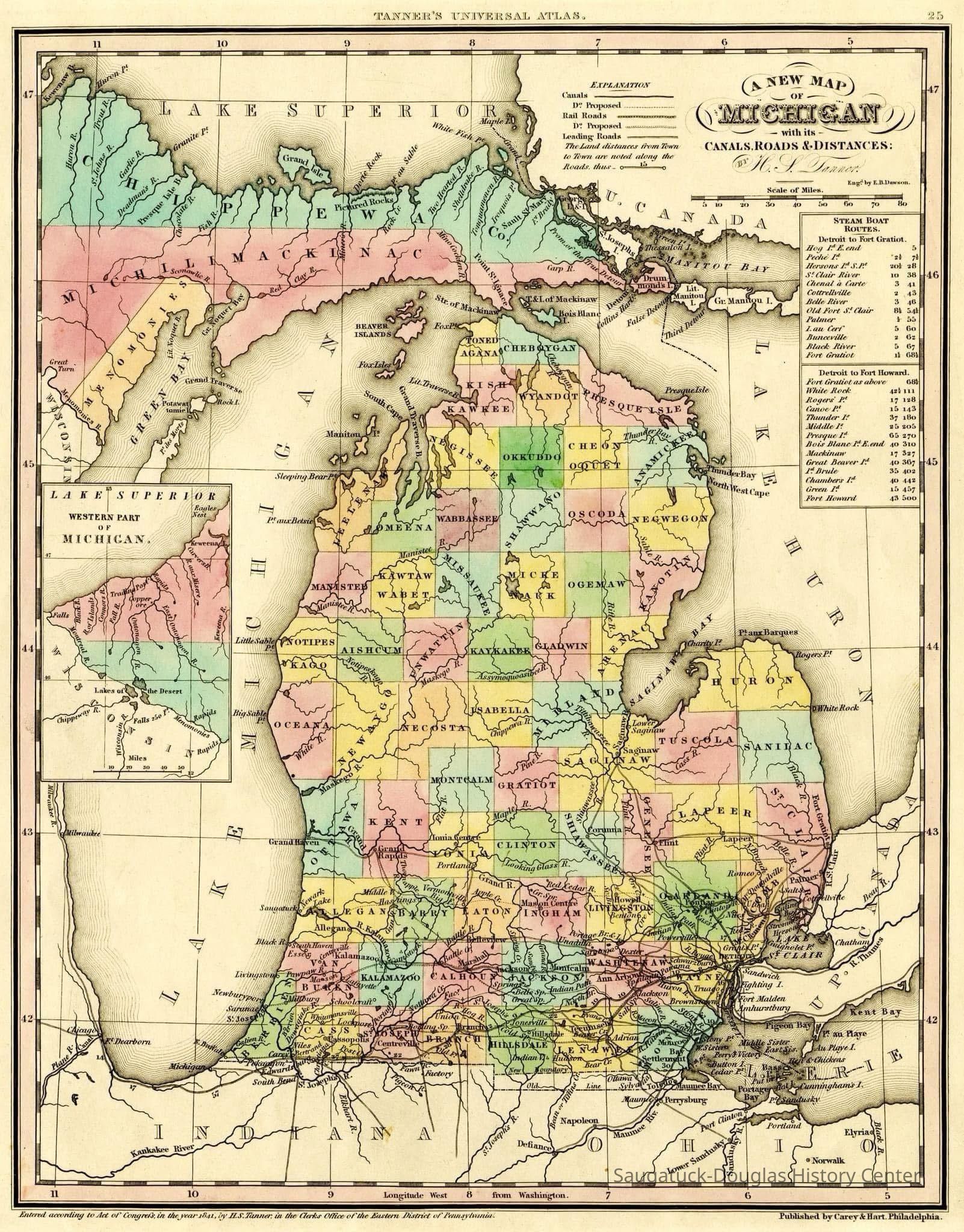
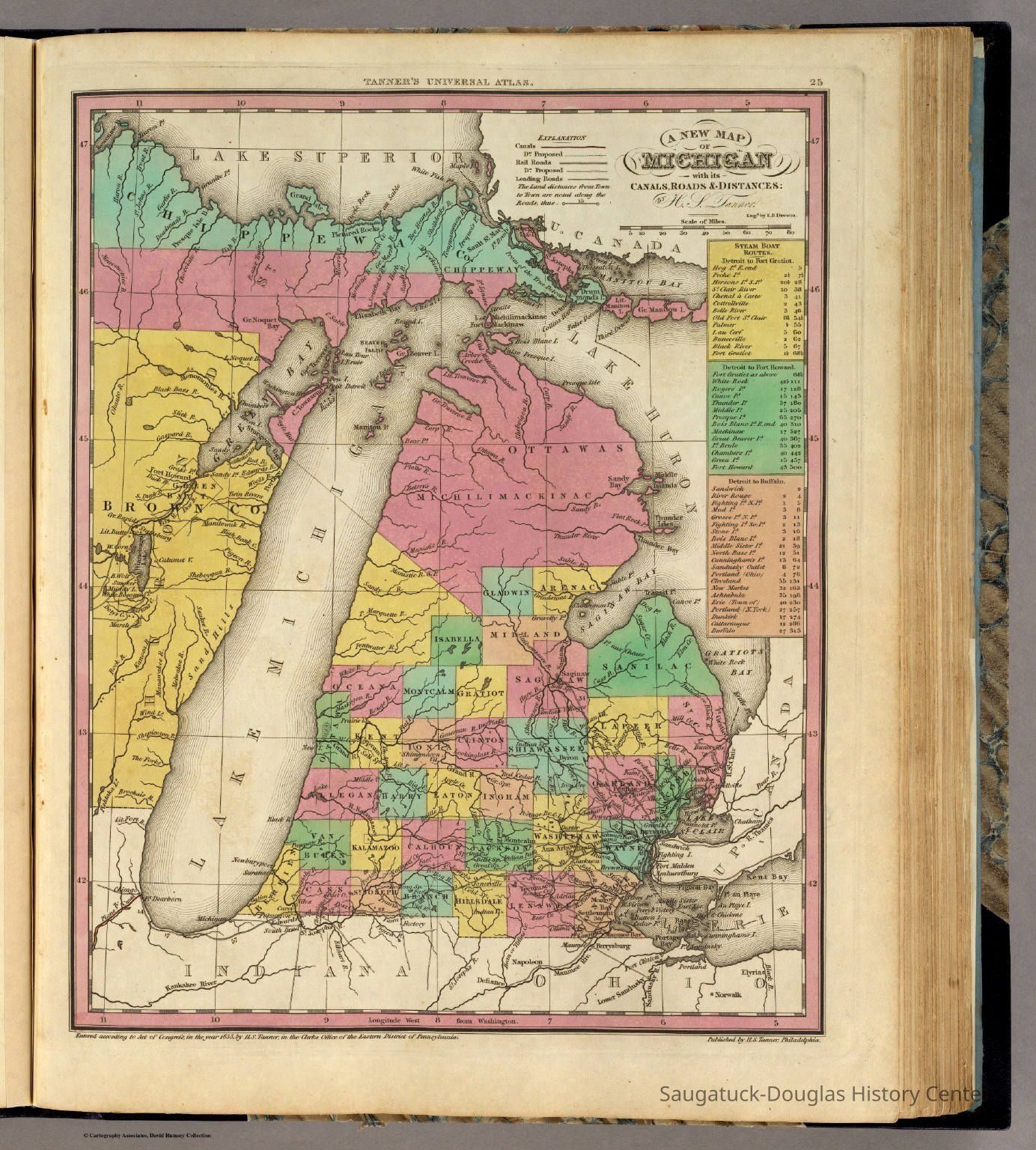
An early map and a subsequent revision that shows Michigan territory before and after statehood in 1837
2025.01.20
Many of the county names have been changed and Kalamazoo Lake is listed at Newark Lake in 1841. Saugatuck is indicated on the 1841 map but not on the 1833 map. Early maps like these were primary sources of information for potential settlers and land speculators.
Maps1830 Settlement, pioneer era
Winthers, Sally
2025.01
Found in Collection
1841 map emailed to Sally Winthers from Steve Hutchins via facebook, May 2025 1833 map found online
Digital data in CatalogIt
05/24/2025
05/24/2025