Kalamazoo Lake and Sewer Authority 2011 Water Reliability Study
Archive
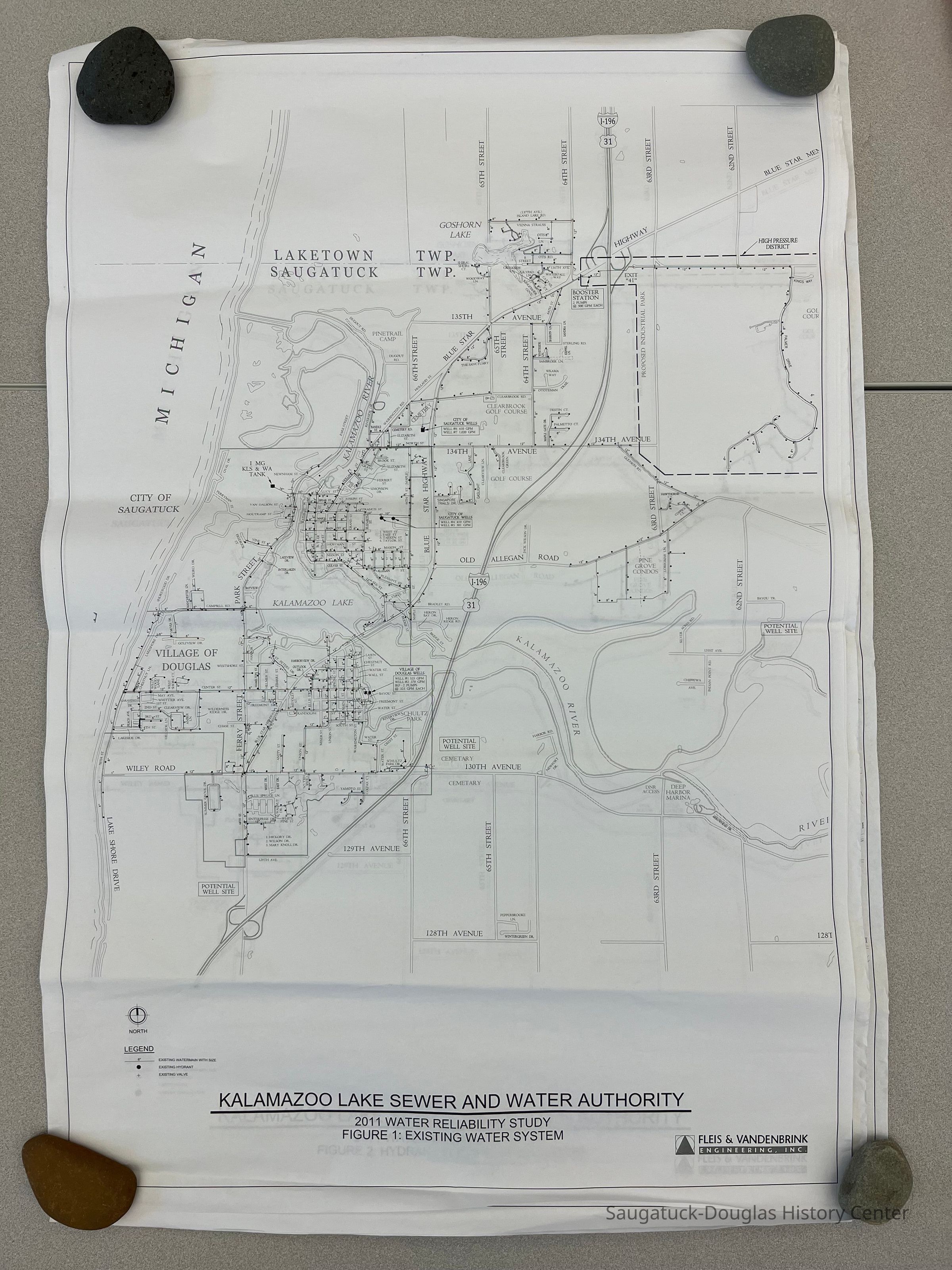
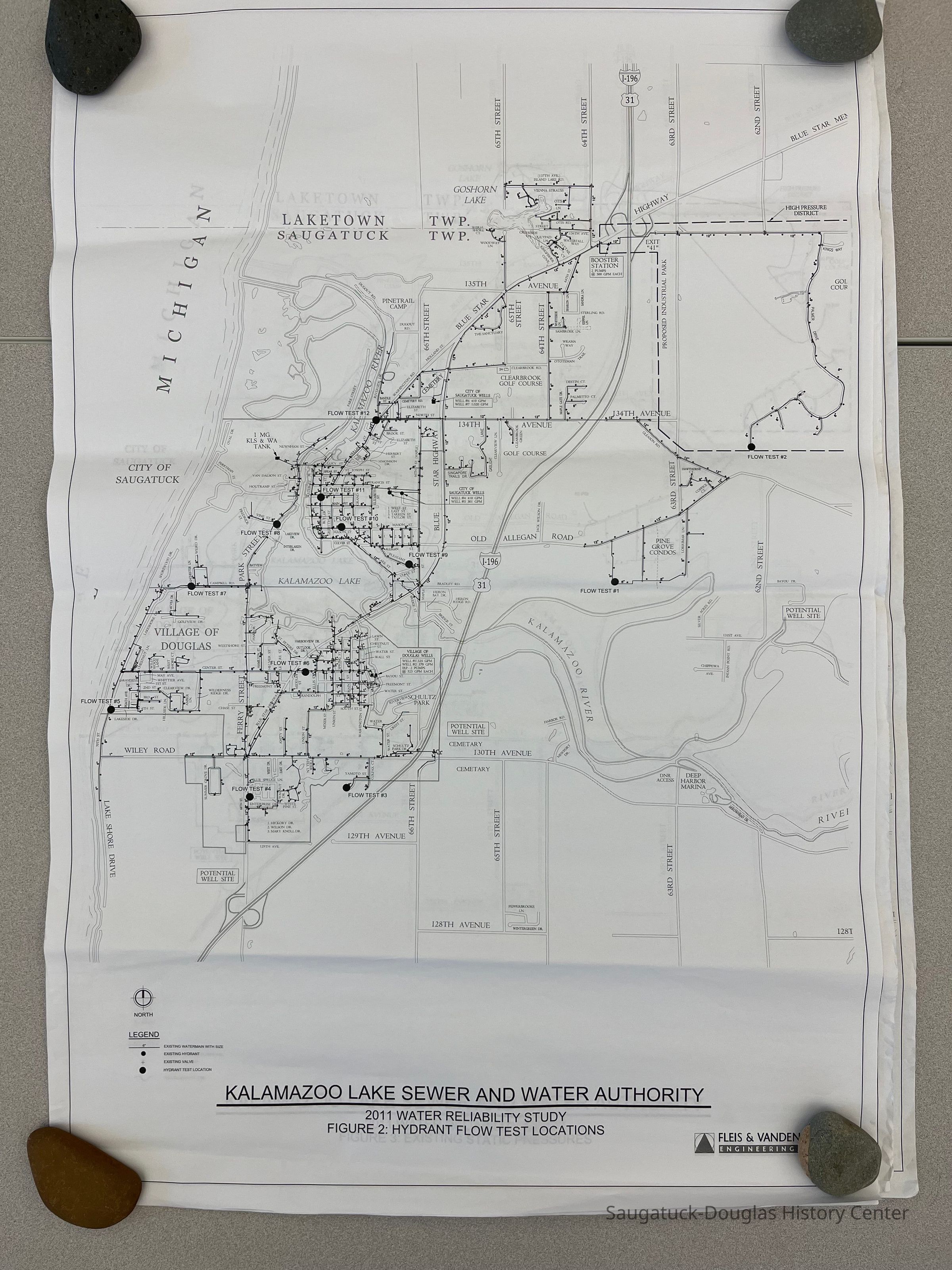
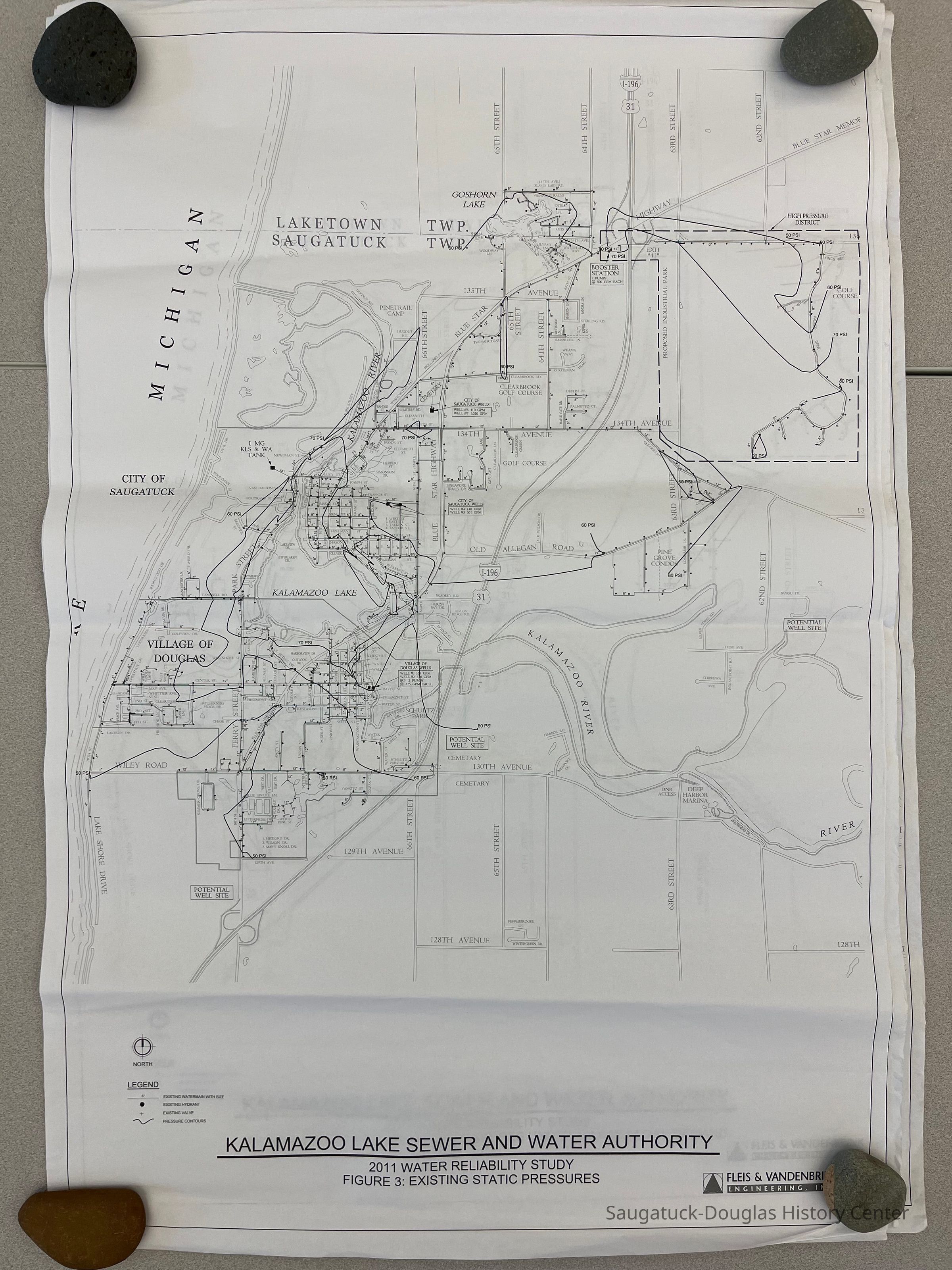
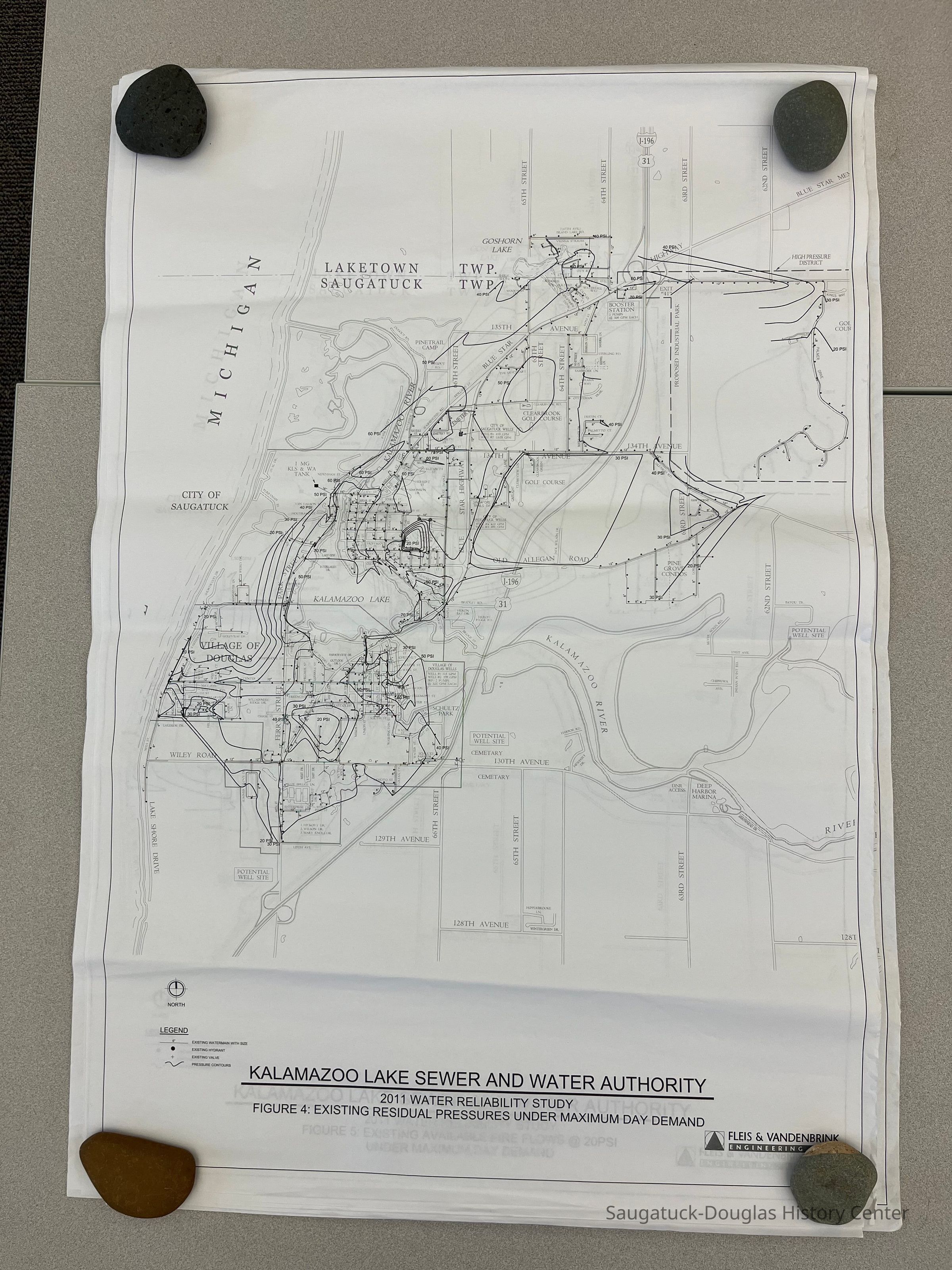
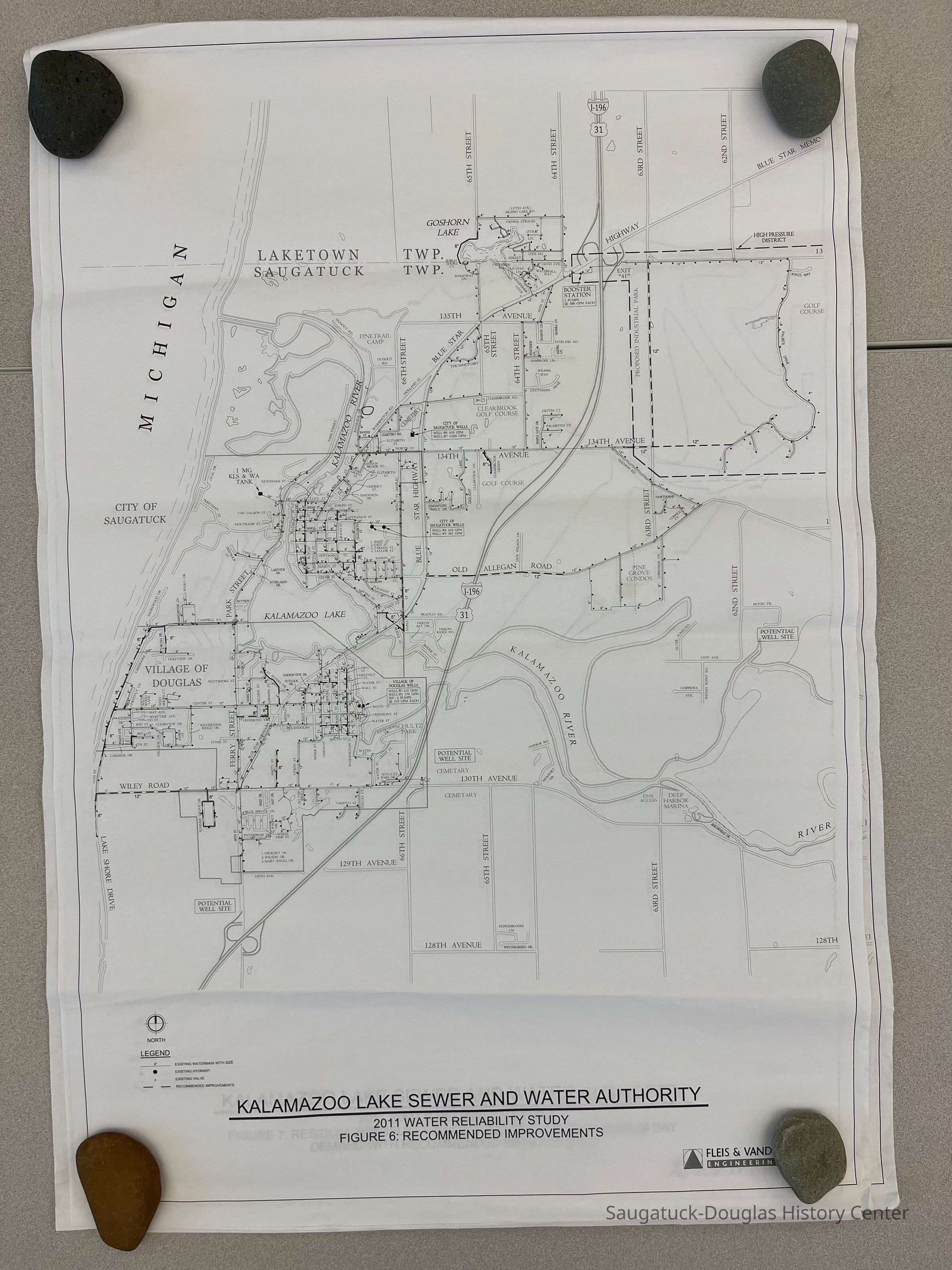
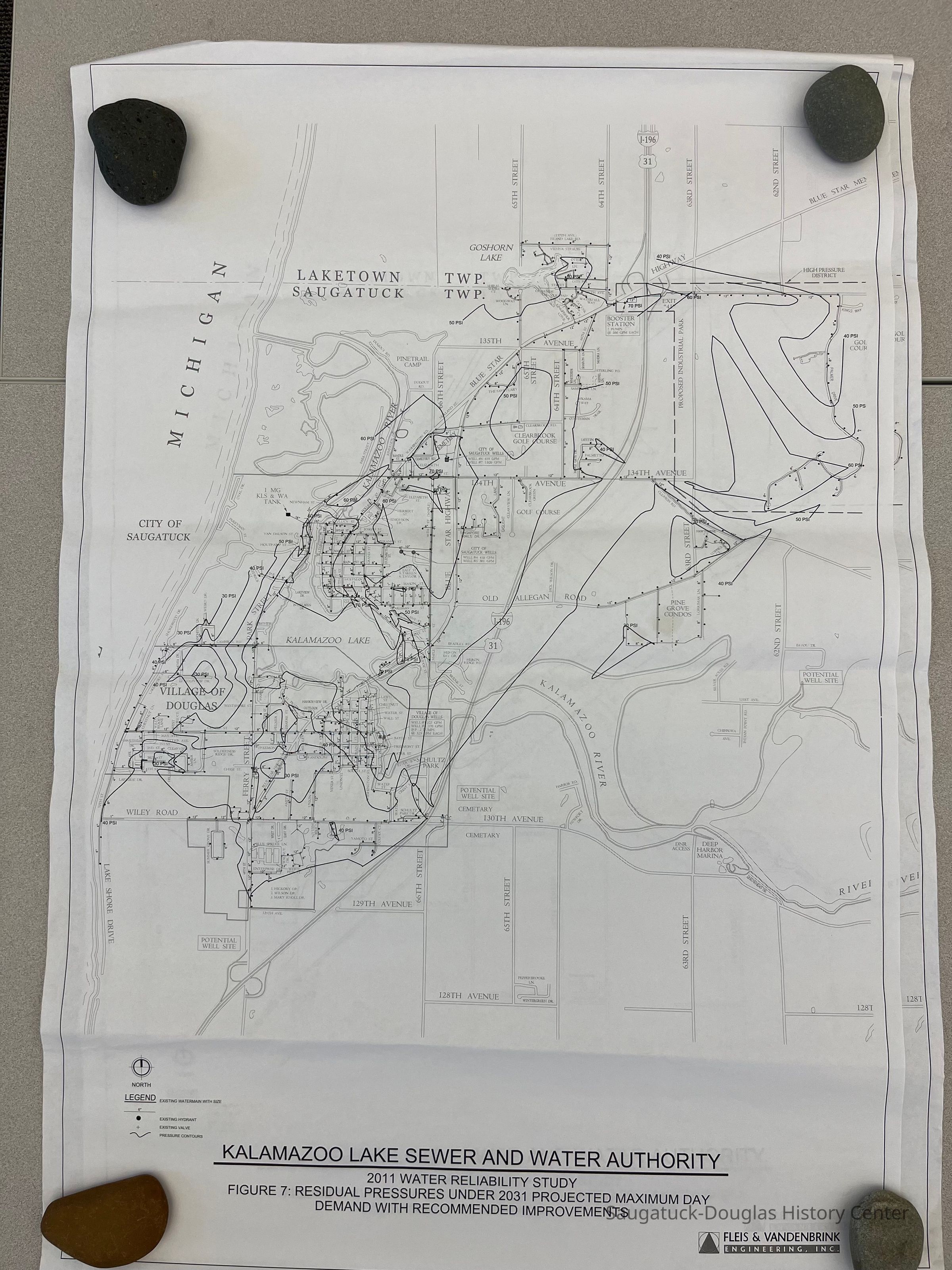
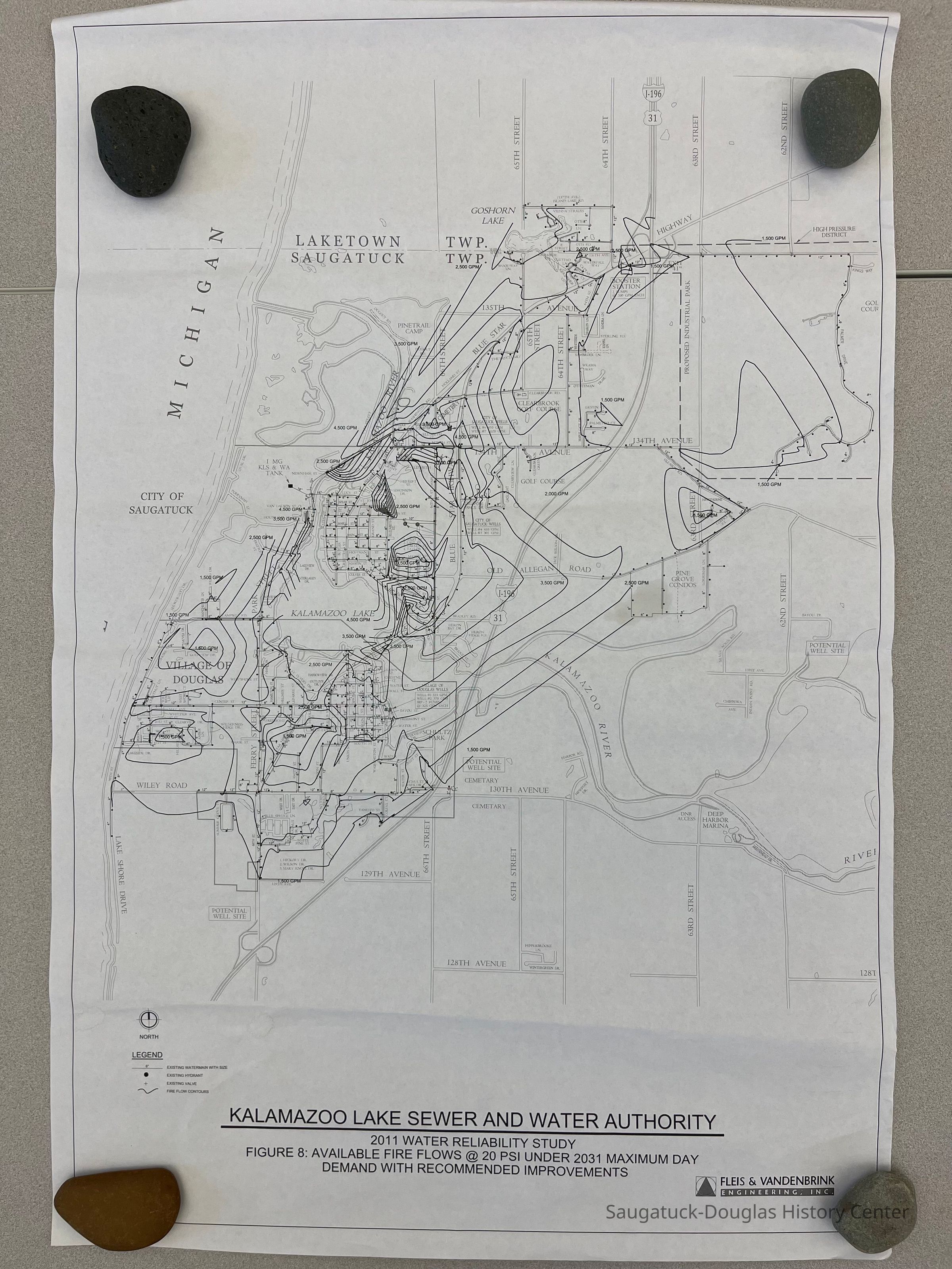
Eight large prints on paper used as documentation for the Kalamazoo Lake Sewer and Water Authority for a 2011 Water Reliability Study. Drawings by Fleis & Vandenbrink Engineering, Inc., #809570-1 thru 8. The map-like drawings cover Saugatuck Township from Lake Michigan to 62nd Street and from the 128th Street to the Township's northern border. The drawings indicate the diameter of water mains, hydrant locations, hydrant test locations, street and highway with names, current and potential well sites, water pressure contours, fire flow contours, recommended improvements and site of a proposed industrial park with a high-pressure district at the SE corner of the Blue Star Highway and 63rd Street.
![Figure 5 Existing Available Fire Flows at 20 PSI [pounds per square inch]](https://d8e7jbdw4fu0e.cloudfront.net/4124/61b49b51-c7ce-11ed-80bc-01e2531d7396-vdTHt0c.lg@2x.jpg)
2023.12.01
The documents give a detailed overview of the water system in 2011.
Winthers, Sally
2023.12
Royce, Frederick Eagle
Donation, unconditional
Public UtilitiesDevelopmentResource managementCivil Engineeringresource managementengineering studycapacityprojected needs
36 in
24 in
Flat Files drawer 05 plans
Very Good
03/20/2023
07/23/2023